
from space to the ground
Satellites are eyes watching the Earth from space.
Satellite technologies play a vital role in the study of climate change, offering a unique global perspective on our planet. With advanced instruments, they continuously monitor key variables such as atmospheric and ocean temperatures, ice cover, sea levels, soil moisture, and vegetation.
This ability to observe continuously on a large scale allows the collection of precise data, which is crucial for understanding the evolution of Earth's climate, identifying the causes of ongoing changes, and developing effective strategies to mitigate their effects. Without satellites, much of the knowledge we have today about climate change would be out of reach.
Observation from space often seems abstract to the untrained eye, but it is inseparable from ground-based observation.Every change seen from satellites has a direct and indirect impact on the global population, intensifying the challenges that both small and large communities face in adapting to climate change.


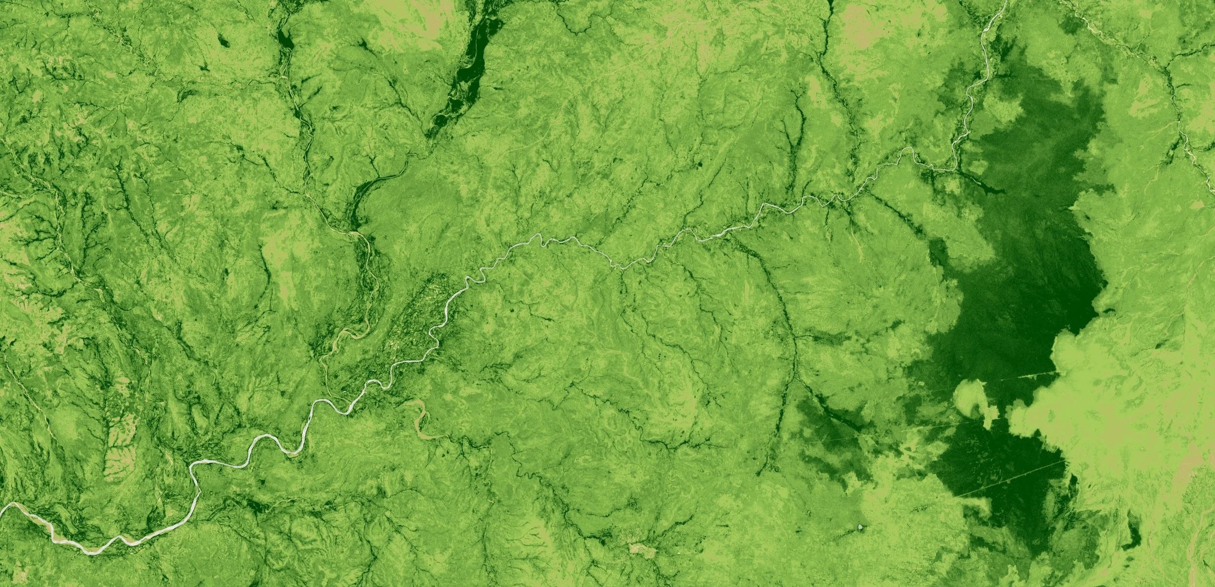
Header image: Satellite photography © Copernicus Sentinel Data 2024, processed by Francesco Vigliotti.
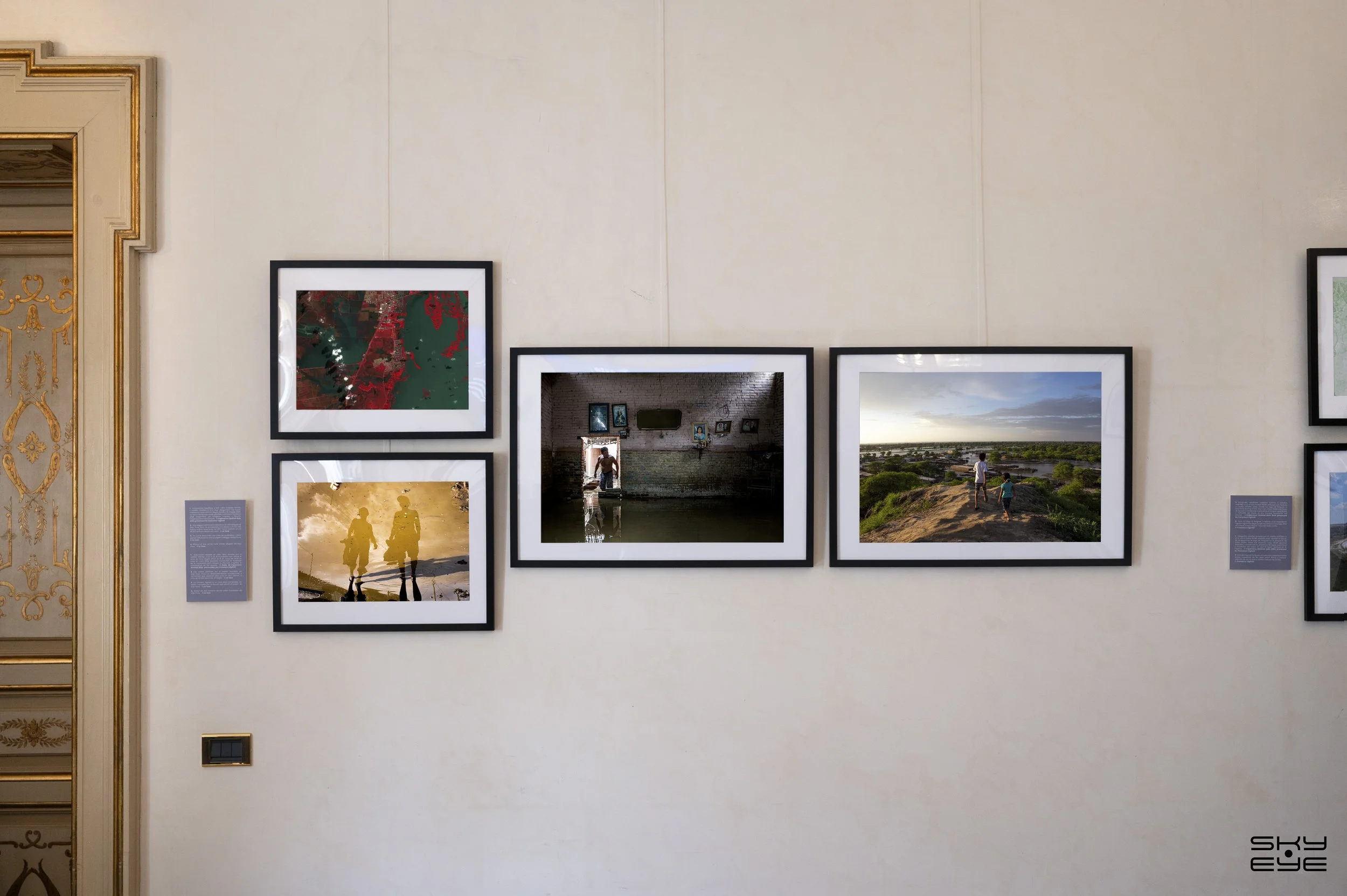
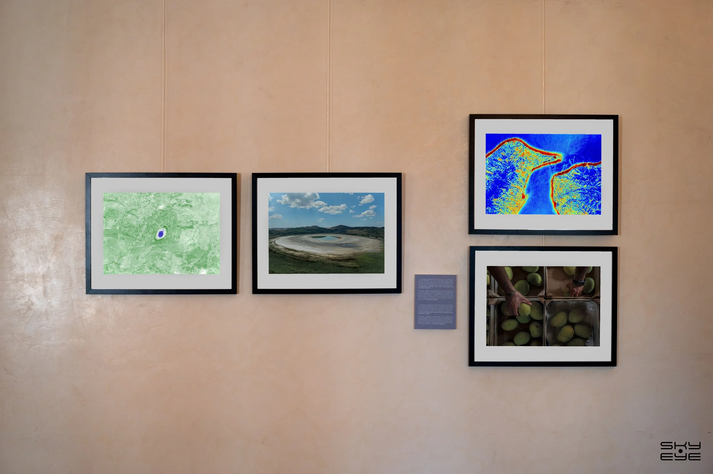
First image: View of part of the Sky Eye exhibition at the Italian-Latin American International Organization.
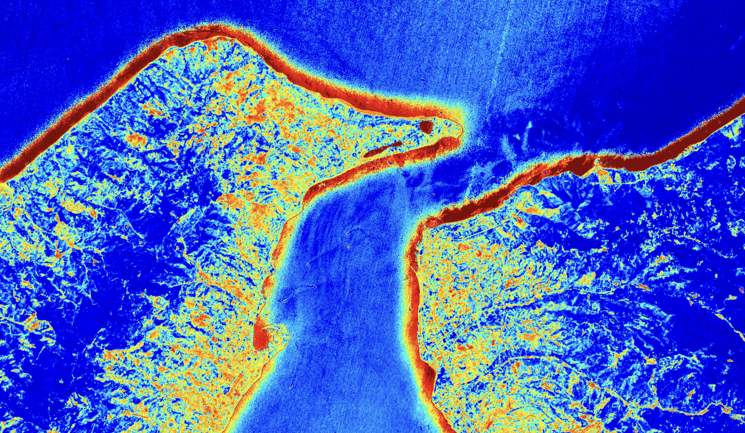
Footer image: Satellite photography © Copernicus Sentinel Data 2024, processed by Francesco Vigliotti.
Secondary image: SKY•EYE framed photos of © Liz Tasa.
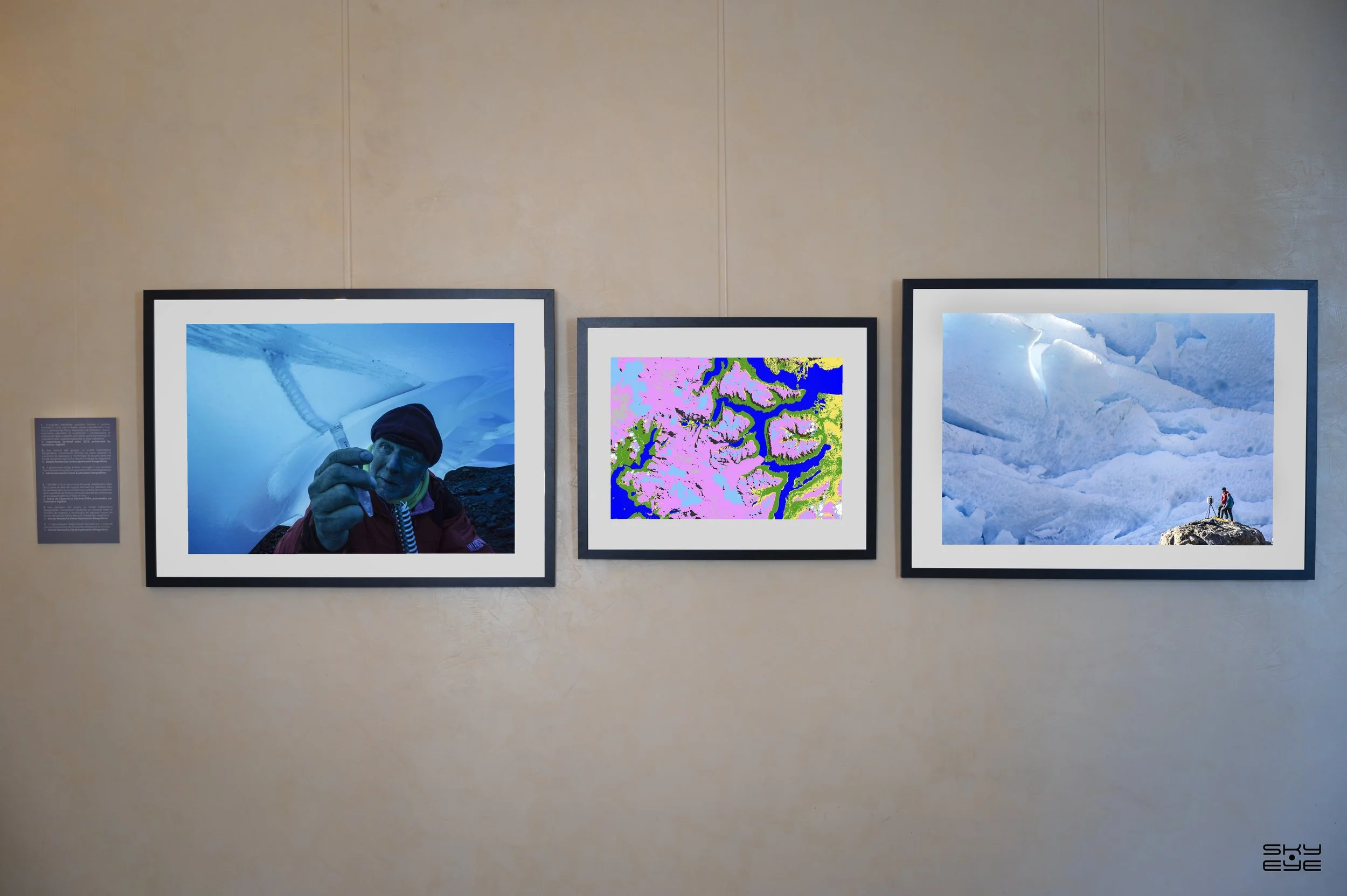
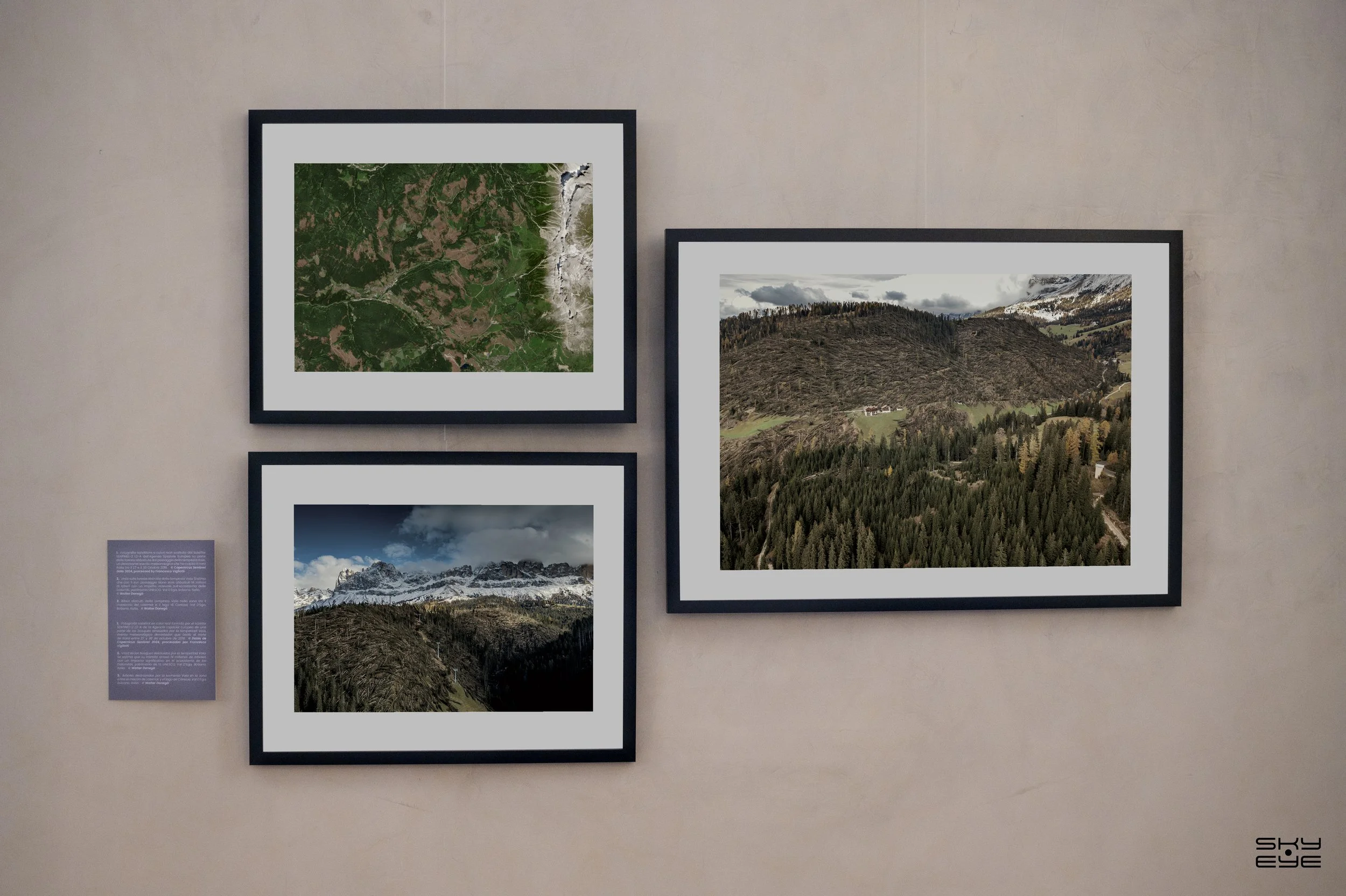
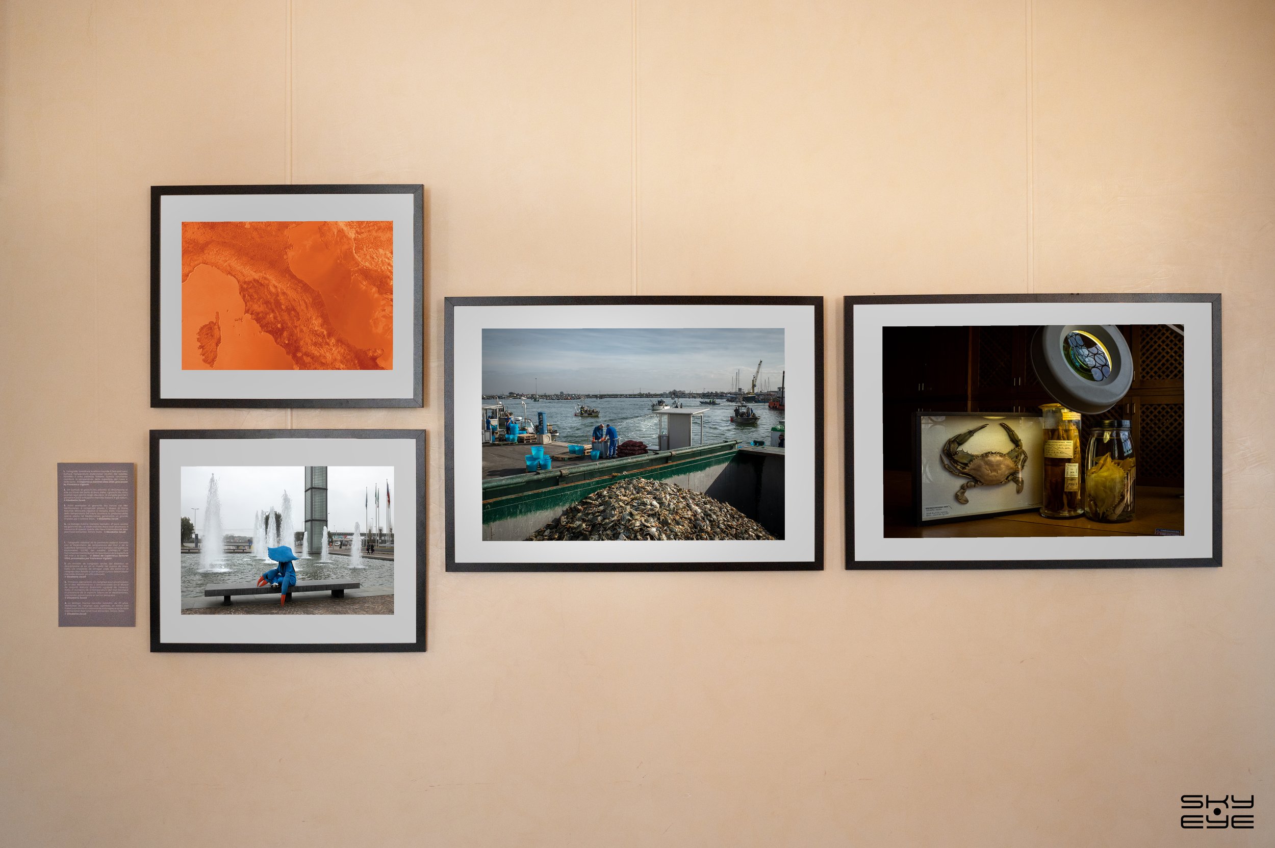
SKY•EYE is a collective and “hybrid” exhibition that connects satellite photographs acquired through the Sentinel satellites of the European Copernicus program with various photographic projects by international photojournalists who have documented impact, adaptation, or mitigation of climate change in the same locations captured from space. Thanks to its numerous applications, SKY•EYE stimulates not only aesthetic reflection but also environmental awareness, placing the viewer at the center of a vision focused on the future of Earth.
“The aim of the SKY-EYE exhibition is to make more understandable the impact of climate change on people lives, by coupling large-scale information, collected from Space satellites, with local-scale stories of affected people, told by photojournalists.”.
The satellite photographs are taken using various indices to highlight some of the critical issues observable from space, such as sea and land temperature variations, drought, soil moisture, flood detection, deforestation, and the reduction of glacial masses.
© Copernicus Sentinel data 2024


-
![]()
Exhibition at Italian-Latin American International Organization IILA
-
![]()
-
![]()
-
![]()
-
![]()
-
![]()
-
![]()


SKY•EYE Exhibition
One of the main uses of SKY•EYE is educational. The images can be used to raise awareness on topics such as climate change, geography and space, providing a powerful visual tool to explain complex global phenomena. In educational contexts, the exhibition can become a laboratory of ideas and discussions, enriching school and university curricula.
Another significant potential application lies in the field of scientific communication and environmental awareness. Sky Eye can be used as a visual project during conferences, public events, or debates serving as a stimulus for broader dialogue on climate change and the need to protect our planet.
Finally, the exhibition can also find its place in cultural contexts, related to the promotion of space, social and environmental responsibility. Cultural festivals celebrating innovation and sustainability can leverage the visual impact of Sky Eye to engage and inspire the public, highlighting the importance of collective commitment to the protection of the planet.

Photographs by: © Elisabetta Zavoli, © Liz Tasa, © Alessio Romeo/La Venta Esplorazioni Geografiche, © Walter Donegà, © Diego Baravelli.
Satellite Photographs: © ESA - Copernicus Sentinel Data 2024 processed by Francesco Vigliotti.
Graphic Design & Logo: © Filippo Toscano.
Opening: 1O October 2024.
Closing: 14 October 2024.
Where: IILA HQ, Italian Latin-American International Organisation, Rome.